PO Box 95
Lyttelton 8841
Te Ūaka recognises Te Hapū o Ngāti Wheke as Mana Whenua and Mana Moana for Te Whakaraupō / Lyttelton Harbour.
Ōtoromiro’s Ocean View
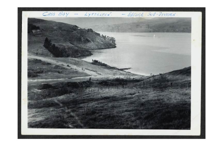
Ōtūtohukai is the Ngāi Tahu name for the ridge west of Dyers Pass Road that overlooks today’s Governors Bay and its thriving village. It means “the place where food was pointed out”, and from its heights looking towards Whakaraupō Lyttelton Harbour one can view the whole domain of what is an important region for Māori, providing shelter and food over many centuries. Today the harbour, its port hills and secluded townsites are home to tangata tiriti and tangata whenua alike. Before British colonisation, one would have looked out over sweeping slopes of dark green native pines down to the quiet sandy bay below and on to the wide vista of the harbour out to the ocean.
The secluded sandy bay below Ōtūtohukai was known to tangata whenua as Ōtoromiro, "the place of the miro” (Prumnopitys ferruginea), the endemic brown pine. When in season, the miro’s red berries attracted the kererū (native pigeon), and the pine’s fine-leaved branches were used for the building of whare. At a certain time of year, whenever the whakarua or north-easterlies were blowing, pioke (sand sharks) would move up towards Ōtoromiro bay where the Māori of Rāpaki would gather to fish them from the shallows. These natural resources made Ōtoromiro a valuable mahinga kai area for the Waitaha, Kāti Māmoe and Ngāi Tahu peoples who lived on the land.
In 1849, some 160 years after Ngāi Tahu laid claim to Whakaraupō, the British Crown acquired 65,000 acres (~26,000 hectares) around Whakaraupō Lyttelton Harbour from the hāpu and iwi. The colonisation of Canterbury followed in quick succession from 1850 with the first Pākehā settlers of the land around Ōtoromiro being Robert and Mary Harris, followed by John Dyer and friends in late 1851. Dyer was a successful farmer and bought land down to the water of the sandy bay, with a jetty and road being built around 1858-62. Thus it was that Ōtoromiro came to be known for a time as Dyer’s Bay. Access to this bay was either via steam or sail boat, the Māori walking trail from Ōhinehou Lyttelton through Rāpaki, or the old Māori track winding up and over Pukeatua (later the Dyers Pass Road) to the Waitaha Canterbury Plains beyond.
As more settlers arrived to farm the harbour's fertile volcanic soils, Whakaraupō became the orchard and market garden for the growing city of Christchurch. In 1856, the Canterbury Provincial Council provided funds for the construction of a carriage-worthy bridle track out to Dyer’s Bay and beyond to cater for the increased traffic in produce and people. William Foster opened the first hotel in the area, the Travellers’ Rest east of Dyers Pass Road, around 1859, at the northern entry to the village that was now more often referred to as the Governor’s rather than Dyer’s Bay. Foster was granted a general licence under the Public House Ordinance in 1862, and when the nearby Foster’s stone bridge (now Radcliffe bridge) was built the following year, the Lyttelton to Governors Bay bridle path was open for heavy wagons.
At some point early on, a Mr FW Beechey purchased the 50 acre (20 hectare) lot above the bridle path overlooking John Dyer’s section down to the Governors Bay Wharf and its sandy bay. It was on this land, at the centre of the growing village, that a second hotel was established in 1870 – the Ocean View Hotel with one May Haulk the founding proprietor. Apparently unlicensed, or perhaps just ‘off the records’, the hotel featured comfortable boarding rooms for travellers with that iconic view at the head of the harbour looking out over the bay to the ocean. Along with the village church, St Cuthbert's, built by Edward Morey in 1860, this village tavern would have been at the heart of the mid-1800s English village life that was then taking form around Ōtoromiro’s secluded bay.
By this time, Dyer’s Bay had long been known as Governors Bay, based on the legend, apparently apocryphal, that Governor Grey anchored Her Majesty's sloop of war Fly there in 1850, instead of in Lyttelton port, when he came down to greet the first of the Canterbury pilgrims. Times were obviously tough for the hospitality business back then and there are a further 15 proprietors recorded after Ms Haulk over the next 30 years through to 1900 when Joseph Bowes ran the Ocean View from 1898-1902. Six more managers came and went until George Parsons took the licence on from 1908-09. Despite the high proprietor churn, the Ocean View Hotel in Governors Bay remained a viable business and focal point of village life under that very name for another 70 years after Mr Parsons sold it on. The longest serving Ocean View publican was Dave Rogers from 1940-1965, followed by Pat and Judy McCarthy from 1965-1975.
In 1980 the Ocean View became the Smugglers Arms for 20 years before being renamed again as Governors Bay Hotel in the year 2000. The current proprietors Jeremy and Clare Dyer have made the old place their home since 2003. The heritage hotel was one of the very few Whakaraupō hotels that survived the 2010/2011 Canterbury earthquakes. Then in 2020, on the occasion of the 150th anniversary of its founding, the old Ocean View Hotel was once again renamed, this time as Ōtoromiro Hotel, bringing our naming story full circle. The establishment remains a favourite haunt of local harbour dwellers and ‘flatlanders’ alike, with its beautiful gardens and peaceful deck still affording a view over the waters of Ōtoromiro towards the ocean.

