PO Box 95
Lyttelton 8841
Te Ūaka recognises Te Hapū o Ngāti Wheke as Mana Whenua and Mana Moana for Te Whakaraupō / Lyttelton Harbour.

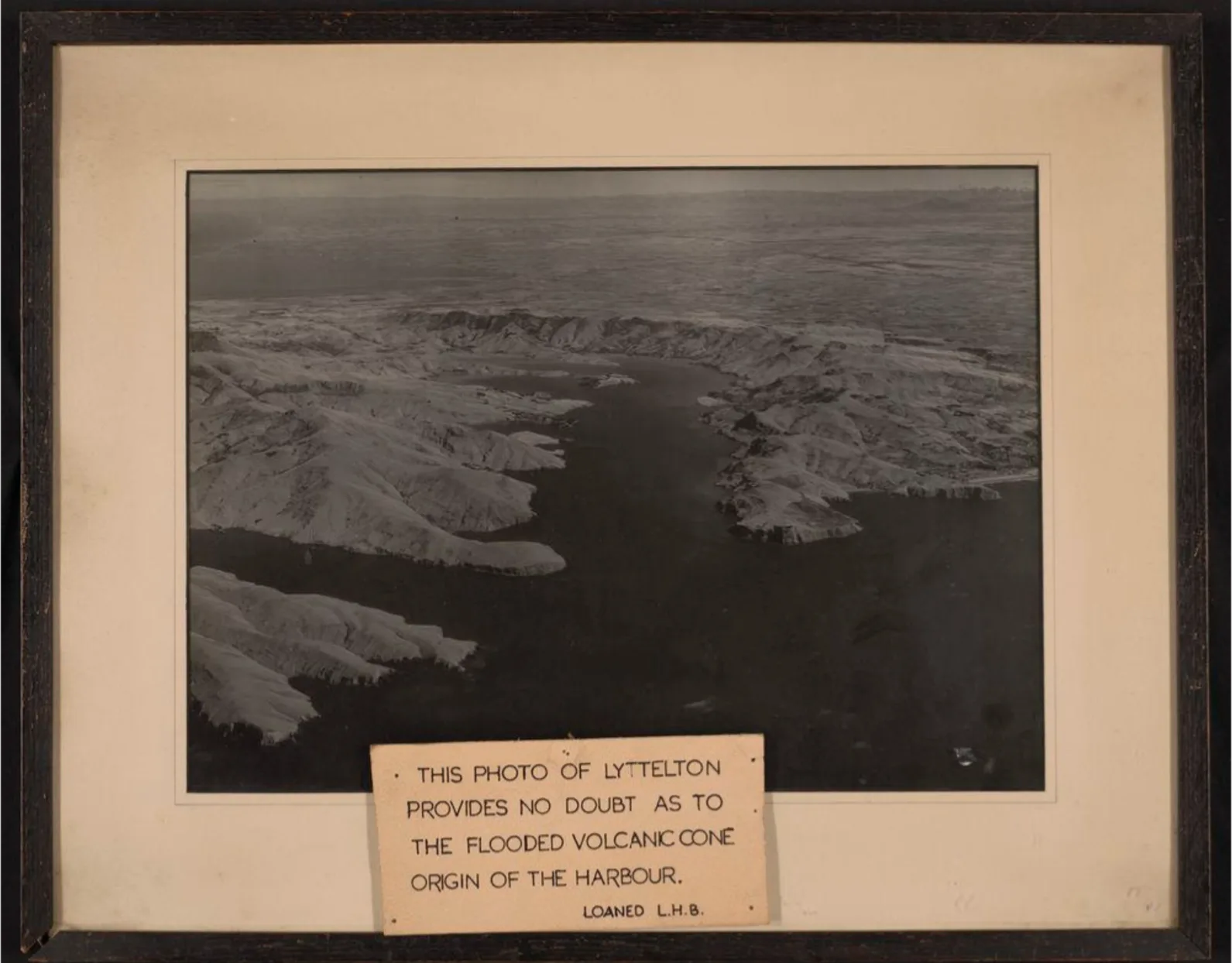
Aerial view of Lyttelton Harbour showing the flooded volcanic cone.
Te Ūaka The Lyttelton Museum ref 14428.1
https://www.teuaka.org.nz/online-collection/1135157
Volcanic Origins
Around 15 million years ago (Ma) the Pacific Ring of Fire became active in our region and began to build the backbone of Te Waipounamu South Island – Ka Tiritiri-o-te-Moana, the great Southern Alps. In the sea to the east of this subduction zone’s great uplifting, new shield volcanoes began to form and rise from the waters. The first of them was the Lyttelton Volcano that began erupting 11 Ma, reaching almost 1000 metres high around 10 Ma before explosively forming the beginnings of today’s natural harbour. As the volcanic activity slowly moved southeast away from Whakaraupō Lyttelton Harbour, it formed Te Ahu Pātiki Mt Herbert Volcano from 9.7 – 8 Ma and then moved on to form the vast Akaroa Volcano from 9 – 8 Ma. Volcanic activity began to subside from around 7 Ma ceasing altogether after 5.8 Ma.
It’s only then, with the never-ending effects of erosion along the volcanic valleys, that we have the beginnings of the weathered volcanic peninsula that we know and love today. Although if Cook had been sailing at the time he would have been correct in calling it an island! It wasn’t until 2 Ma that glaciers began to grind the Southern Alps down, with their rock and loess slowly forming the Canterbury Plains. And around 20,000 years ago those plains finally reached the volcanic island to form Horomaka Banks Peninsula.
Aerial view of Lyttelton Harbour showing the flooded volcanic cone.
Te Ūaka The Lyttelton Museum ref 14428.1
https://www.teuaka.org.nz/online-collection/1135157
See also https://ir.canterbury.ac.nz/handle/10092/4117

